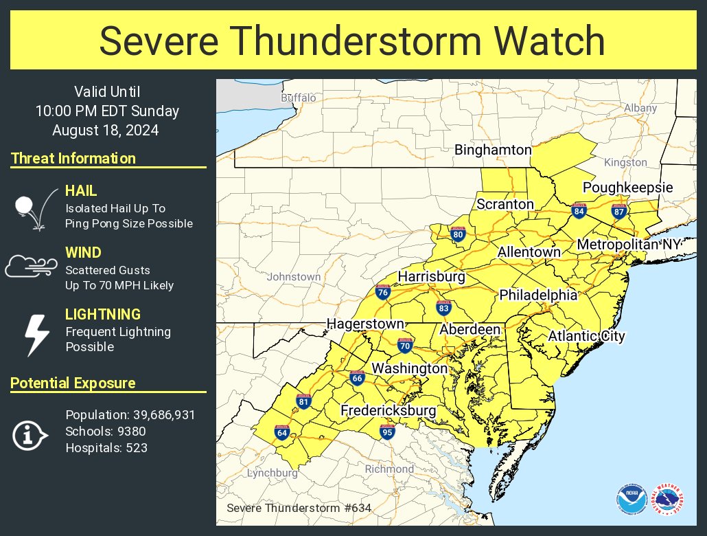
The National Weather Service has issued a severe thunderstorm watch for the region until 10 p.m. on Sunday, August 18. A slow-moving cold front will bring showers and thunderstorms throughout the day. The highest chances of precipitation are expected this afternoon and evening as the front moves across the area.
We can expect the storms to produce damaging wind gusts and isolated instances of flooding. The potential for large hail or an isolated tornado also exists due to increasing instability in the atmosphere, according to the National Weather Service.
A Flood Watch has also been issued from 2 to 8 p.m. this afternoon through this evening for parts of Northeast Maryland and the Washington, D.C. area. Some storms may produce rainfall rates of one to two inches per hour, leading to isolated instances of urban flooding in vulnerable areas.
Temperatures are expected to range from the 70s to 80s, with overnight lows dropping into the 60s to low 70s. After the cold front passes, dry conditions and cooler temperatures will return next week as high pressure builds in from the northwest.