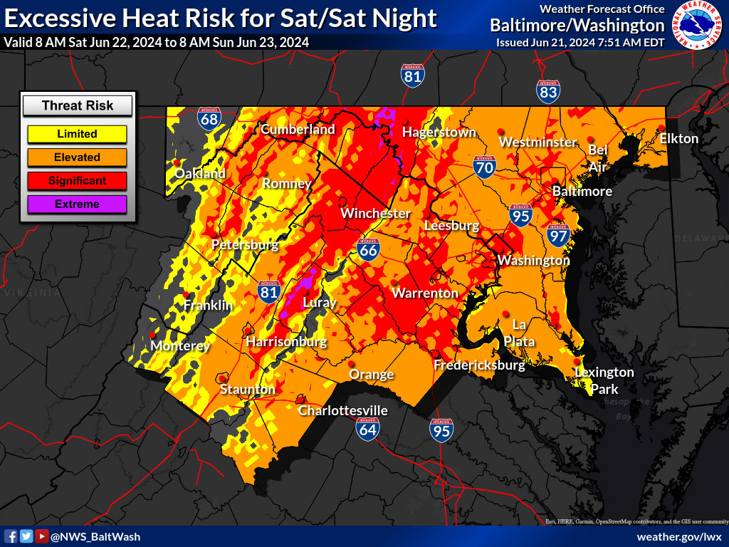
The National Weather Service has warned about dangerously hot conditions in the region through the weekend. High pressure will remain offshore, and the current weather pattern will be maintained until Monday.
High pressure is centered offshore with upper-level ridging in place. Temperatures are expected to reach the mid-90s for most areas, with mid-to-upper 80s in the mountains. Terrain-driven circulations may cause thunderstorms this afternoon over the Allegheny Front and Potomac Highlands, but conditions will remain dry further east. Any storms will dissipate this evening, leading to overnight lows in the low to mid-70s for most areas and upper 60s in the mountains.
Looking ahead to Saturday, high pressure will remain offshore. This will draw hot air into the region, pushing temperatures to the upper 90s to near 100. Dewpoints will increase into the upper 60s to lower 70s, resulting in heat index values of 100-110. An Excessive Heat Watch is in effect for much of the area on Saturday afternoon.
A surface trough is expected to develop, leading to showers and thunderstorms in response to daytime heating. Any storms will dissipate after dark, with overnight lows in the mid-to-upper 70s and possibly lower 80s.
On Sunday, high temperatures will reach the mid-to-high 90s, with heat index values of 100-110 east of the Blue Ridge. Thunderstorms are possible Sunday afternoon into Sunday night, with severe storms capable of producing damaging winds. The Storm Prediction Center has placed much of the area at a marginal risk for severe thunderstorms on Sunday.
Recent Stories
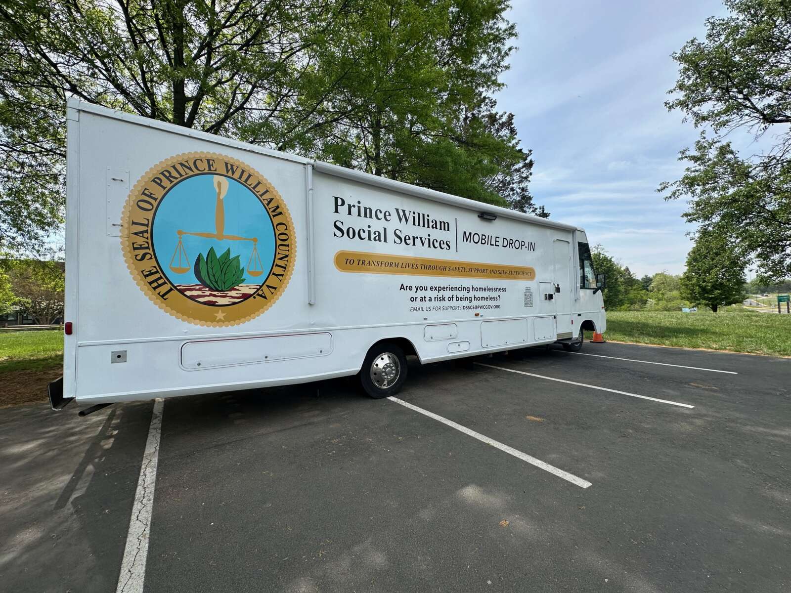
The Prince William County Homeless Mobile Unit resumed operations this spring, offering weekly support to homeless residents in the western part of the county.

Michele Hupman, Principal of Weems Elementary School, has been named the 2025 Washington Post Principal of the Year for Manassas City Public Schools (MCPS).

The Fredericksburg Nationals (9-9) were shut out for the first time this season, falling 6-0 to the Charleston RiverDogs (8-10) on Thursday at Virginia Credit Union Stadium.
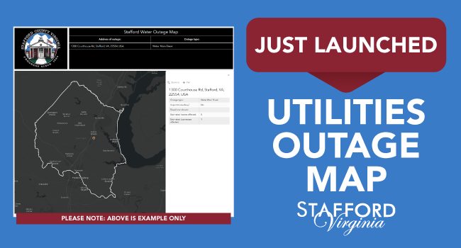
Stafford County Utilities has introduced a new online tool to provide residents with real-time updates on water outages and repair work.
Inspired by local physicians who were among the nation’s first to adopt the concierge medicine model, Northern Virginia is now a hub for its surging popularity. These leading physicians are redefining the patient experience with same-day appointments, direct availability, unhurried visits, and deeply personalized care:
After almost 40 years in practice, Manassas-based Internist John Cary, MD’s change to concierge medicine enabled focused attention for each individual, and the launch of his innovative diet program for those with type 2 diabetes. “The goal is to promote enough weight loss to reach an acceptable A1C of 6% with no medication,” he explains. “Achieving that can take several months of very close follow up. As I tell my patients, we are in this together.”
Jay Tyroler, MD considers his patients quite literally as family. “I believe there’s nothing more honorable than helping patients when they’re sick, or scared, or feeling vulnerable, and I care for them exactly as I would my loved ones.” Whether for a specialist referral, urgent health issue or ongoing follow up, “My patients know I’m always just a phone call away.”

Get More from your Fitness with IM=X® Pilates & Fitness King Farm!
Help us Celebrate our 5 Year Anniversary by joining our OPEN HOUSE
When: April 27th 11:45AM
Your Weight Matters National Convention

Hosted by the Obesity Action Coalition (OAC) since 2012, this highly-anticipated gathering is the nation’s leading gathering focused on empowering individuals with science-based education, support and practical tools for managing weight and improving health.
This unique Convention truly has something
Van Metre 5K Run

Participate in the 33rd Annual Van Metre 5K Run—a race that goes further than 3.1 miles, where every stride you take supports Children’s National Hospital. The Van Metre 5K Run donates 100% of proceeds to Children’s National Hospital and has