
 Today’s weather forecast is sponsored by Water’s End Brewery. Sometimes all you need is a Damn Beer. Take 96oz of this crisp, Golden Ale brewed fresh by Water’s End Brewery to-go with you in a 6-Pounder for just $14.99!
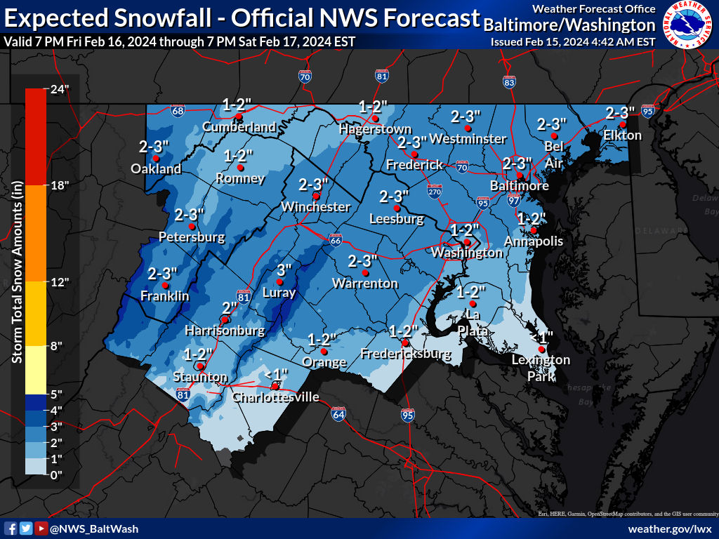 As high pressure gradually builds in this morning, we’re bracing for winter weather set to arrive late Friday. The National Weather Service predicts a clipper-type low-pressure system will move through, followed by another system bringing snow to the area Friday night into Saturday.
Here’s what to expect:
Today’s Outlook:
- Cloud cover will increase throughout the day, with temperatures ranging from the 40s to 50s.
- Temperatures will drop behind the cold front tonight, with lows in the 30s for most areas and 20s in the mountains.
Friday through Saturday Night:
- Brief high pressure will offer a temporary respite early Friday before another clipper system approaches. This system is expected to pass to the south, potentially bringing snow to the region, particularly areas along the higher elevations.
- Snowfall totals are anticipated to range from 1 to 3 inches for most of the area, with the possibility of 3 to 6 inches in higher elevations. However, uncertainties persist regarding the track of the low and total precipitation.
- Saturday morning may see lingering upslope snow along the Alleghenies before precipitation clears out. High pressure will build in behind the system, leading to dry conditions for the remainder of Saturday.
- Cloud cover will decrease through Saturday, allowing temperatures to rebound into the 30s to low 40s outside of mountainous areas, with lows dropping into the 20s for much of the region and into the teens for mountainous regions.
Weekend Outlook:
- Sunday is expected to be sunny, with temperatures reaching a high near 46.
