
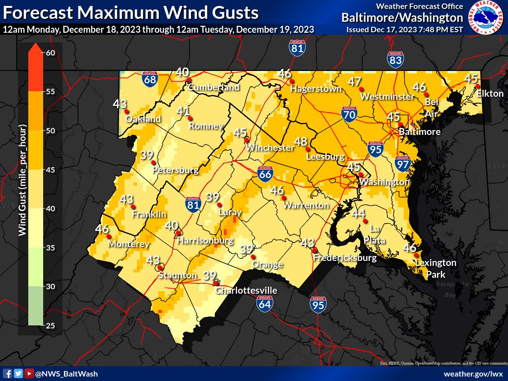
“Wind Advisories are in effect from Monday morning into Monday afternoon for much of the region. Northwest winds of 20-30 mph can be expected, with gusts up to 50 mph at times. Winds subside a bit Monday night before increasing again Tuesday,” reports the National Weather Service Baltimore-Washington office.
Meanwhile, heavy rain continues to fall across the region, prompting the weather service to post a flood watch until 6 a.m. Monday, Dec. 18, 2023.
WHAT…Flooding caused by excessive rainfall continues to be possible.
WHERE…Virginia, including the following areas, Arlington/Falls Church/Alexandria, Central and Southeast Prince William/Manassas/Manassas Park, Eastern Loudoun, Fairfax, King George, Northwest Prince William, Spotsylvania and Stafford.
WHEN…Through late tonight.
IMPACTS…Excessive runoff may result in flooding of rivers, creeks, streams, and other low-lying and flood-prone locations. Flooding may occur in poor drainage and urban areas. Storm drains and ditches may become clogged with debris.
ADDITIONAL DETAILS…A widespread two to three inches of rain is likely tonight into early Monday morning. This amount of rain could cause flooding of small streams, creeks, and urban areas. Localized amounts of up to 4 inches are possible east of I-95, particularly across southern Maryland. Please visit www.weather.gov/safety/flood for flood safety and preparedness information
