Join

Haymarket sees 1 foot of snow; others see several inches

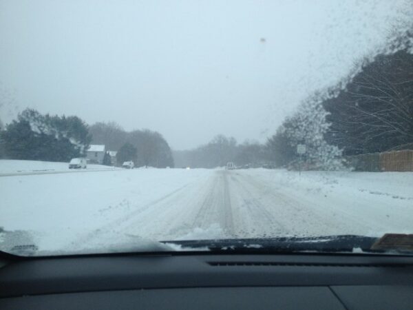
Snow began falling about 8 a.m. Saturday across the region and kept falling until about 5 p.m.

Afterward, we saw the precipitation changeover from snow to sleet, then to rain.

By the time it moved out early this morning, ice coated sidewalks, handrails, and cars. Underneath the ice is several inches of snow.

Take a look at these snow totals from the National Weather Service:

…CITY OF MANASSAS…

   1 NE MANASSAS          6.1   808 PM  2/21  TRAINED SPOTTER        

   1 SW MANASSAS PARK     4.0   530 PM  2/21  TRAINED SPOTTER        


…PRINCE WILLIAM COUNTY…

   HAYMARKET             12.0   911 PM  2/21  PUBLIC                 

   5 NW GAINESVILLE       7.8   555 PM  2/21  PUBLIC                 

   2 SW WOOLSEY           7.7   705 PM  2/21  TRAINED SPOTTER        

   GAINESVILLE            6.8  1000 PM  2/21  TRAINED SPOTTER        

   2 ESE INDEPENDENT HI   4.5   635 PM  2/21  TRAINED SPOTTER        

   1 ENE DUMFRIES         3.0   810 PM  2/21  TRAINED SPOTTER  


…SPOTSYLVANIA COUNTY…

   3 NW SPOTSYLVANIA      2.8   530 PM  2/21  PUBLIC      


…FAUQUIER COUNTY…

   OPAL                   8.5   710 PM  2/21  NWS EMPLOYEE           

   1 NW OPAL              8.5   658 AM  2/22  TRAINED SPOTTER        

   NEW BALTIMORE          7.0   725 PM  2/21  TRAINED SPOTTER        

   1 WSW NEW BALTIMORE    6.0   624 PM  2/21  TRAINED SPOTTER      


…FAIRFAX COUNTY…

   RESTON                 9.3   845 PM  2/21  PUBLIC                 

   1 NNE RESTON           8.5  1052 PM  2/21  TRAINED SPOTTER        

   2 SSW HERNDON          8.4   819 PM  2/21  TRAINED SPOTTER        

   1 SSW FAIRFAX          8.0   745 PM  2/21  TRAINED SPOTTER        

   2 N CHANTILLY          7.8   530 PM  2/21  COCORAHS               

   2 N RESTON             7.3   633 PM  2/21  NWS EMPLOYEE           

   3 NNE CHANTILLY        7.0   811 PM  2/21  TRAINED SPOTTER        

   2 E CHANTILLY          6.5   800 PM  2/21  TRAINED SPOTTER        

   2 N CENTREVILLE        6.5   625 PM  2/21  TRAINED SPOTTER        

   2 SSE MCLEAN           6.2   544 PM  2/21  PUBLIC                 

   HERNDON                6.0   538 PM  2/21  BROADCAST MEDIA        

   VIENNA                 6.0   750 PM  2/21  CO-OP OBSERVER         

   1 SE CENTREVILLE       6.0   723 PM  2/21  TRAINED SPOTTER        

   1 S WEST MCLEAN        5.9   700 PM  2/21  COCORAHS               

   1 S VIENNA             5.5   610 PM  2/21  TRAINED SPOTTER        

   VIENNA                 5.0   600 PM  2/21  TRAINED SPOTTER        

   MCLEAN                 5.0   529 PM  2/21  NWS EMPLOYEE           

   3 NW CLIFTON           5.0   547 PM  2/21  BROADCAST MEDIA        

   1 W FALLS CHURCH       4.9   655 PM  2/21  TRAINED SPOTTER        

   1 NNE FAIRFAX STATIO   4.0   616 PM  2/21  TRAINED SPOTTER        

   1 E FAIRFAX STATION    4.0   529 PM  2/21  TRAINED SPOTTER        

   1 NW ANNANDALE         4.0   700 PM  2/21  TRAINED SPOTTER        

   1 SE FAIRFAX           3.8   627 PM  2/21  TRAINED SPOTTER        

   1 E BURKE              3.5   531 PM  2/21  PUBLIC


…DISTRICT OF COLUMBIA…

   1 WSW NATIONAL ARBOR   8.0  1000 PM  2/21  TRAINED SPOTTER        

   1 ENE ADAMS MORGAN     4.6   838 PM  2/21  PUBLIC                 

   1 SW AMERICAN UNIVER   4.3   610 PM  2/21  TRAINED SPOTTER


Recent Stories

Stafford County authorities are still looking for a bank robber who simply peddled away.

Yugene Vindman, a Democrat of Lake Ridge, who’s running to replace Abigail Spanberger (D) in Congress, is calling for a review of Virignia’s State Flag, one of the most unique in the world.

A stationary front lingering across central Virginia is expected to gradually shift northward today, transforming into a warm front by early Thursday, according to forecasts from the National Weather Service.

A Howard University student has died after he was struck last week by a car reportedly driven by a faculty member…Mohamed Samura, of Fredericksburg, 18, was a computer information systems major at the university.

Are you feeling overwhelmed by life’s challenges? Do stress and anxiety seem to dominate your thoughts? At Peaceful Mind Solutions, we understand that navigating mental health can be daunting, but you don’t have to do it alone.

Our team of compassionate therapists is here to guide you on your journey toward inner peace and emotional well-being. With a client-centered approach, we tailor our therapy sessions to meet your unique needs and goals. Whether you’re struggling with depression, coping with trauma, or simply seeking personal growth, we provide a safe and supportive space for healing and growth.

Embark on a path of self-discovery with our comprehensive range of therapy services, including cognitive-behavioral therapy, mindfulness practices, and holistic approaches. Our experienced therapists are dedicated to helping you cultivate resilience, develop coping skills, and foster a greater sense of self-awareness.

Read More

Submit your own Community Post here.

Are you facing life’s challenges, feeling overwhelmed, or seeking personal growth? Embrace the path to emotional well-being with our expert psychotherapy services!

Why Choose Us?

Our team of compassionate and experienced psychotherapists is here to guide you on your journey to inner peace, self-discovery, and positive change. We provide a safe and supportive environment where you can explore your thoughts and feelings without judgment.

Read More

Submit your own Community Post here.

Free Irish Music Concert

Welcoming Spring with music from the Emerald Isle, the New Dominion Choraliers offer a FREE concert on Saturday, April 27 at 7:30 p.m. at the First United Presbyterian Church of Dale City.

Joined by Legacy Brass and members of Old

Spring Ceili: An Irish Music Festival

The New Dominion Choraliers of Prince William County and McGrath Morgan Academy of Irish Dance invite you to join them at our Ceili, a grand celebration of Irish music and dance.

A gathering of performance groups throughout Prince William County

×

Subscribe to our mailing list