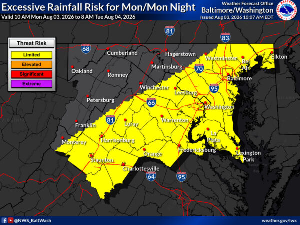
Two state senators are asking Gov. Abigail Spanberger to call a special session of the General Assembly after a newly released state report found groundwater supplies in eastern Virginia may not support major new withdrawals under current regulations, The Center Square reported. Sens. Richard Stuart, R-King George, and Russet Perry, D-Loudoun, said the Department of Environmental Quality study shows “virtually no capacity” in the Coastal Plain aquifer for large new uses such as data centers and was released only after the 2026 session had adjourned.
The bipartisan letter notes ongoing strain already appearing in western Loudoun and northern Fauquier counties and urges lawmakers to act on the report’s recommendations for stronger permitting rules, improved monitoring, and tying local development more closely to groundwater availability rather than waiting until the 2027 session.